1,900+ results for map of missouri
- 1846 IOWA TERRITORY MICHIGAN Map ORIGINAL Ohio Michigan Kentucky MissouriOpens in a new window or tab$70.00Free shippingFree returnsSponsoredselsa84 (5,119) 100%
- Original 1882 Map of Missouri by Phillips & Hunt. AntiqueOpens in a new window or tab$17.00Free shippingFree returnsSponsored20% off 5+Top Rated Plusalazarus (5,492) 100%
- 1832 MISSOURI Map ORIGINAL St Louis Bounty Lands Counties Indians New MadridOpens in a new window or tab$85.00Free shippingFree returnsSponsoredselsa84 (5,119) 100%
- New ListingVintage MISSOURI Atlas Map - 1968 Collector's Edition EBC Atlas of the WorldOpens in a new window or tab$10.44Was: $14.9130% off+$6.70 shippingFree returnsSponsoredExtra 5% off with couponwanderama_resale (9,130) 99.9%
- ANTIQUE 1871 HAND-COLORED CITY COUNTY MAP OF IOWA/MISSOURI by AUGUSTUS MITCHELL!Opens in a new window or tabPre-Owned$9.990 bids · Time left57m left (Today 04:01 PM)+$4.99 shippingamericana64 (12,161) 100%
- New ListingThe New Reference Atlas of the World - 1914 Map of Wisconsin & MissouriOpens in a new window or tab$5.00+$6.00 shippingmjuhl1967 (785) 100%
- Vintage 1950's LAKE OF THE OZARKS Missouri Travel Road Tourist Map Bagnell DamOpens in a new window or tabPre-Owned$24.99+$4.38 shippingtrinkettreasure396 (1,302) 100%
- New Listing1889 Rand McNally Map of St. Joseph, Missouri (14.5" x 22")Opens in a new window or tab$25.000 bids · Time left6d 17h left (Mon, 08:48 AM)$32.50Buy It Now+$9.00 shippinggosshollow (271) 100%
- Antique Colorful 1908 Map Of Missouri 20x16 InchesOpens in a new window or tab$14.50+$4.68 shippingbenjter-51 (216) 100%
- 1938 Rand McNally Map Kansas City Plan Missouri Stock Yards Railroads IndustryOpens in a new window or tab$12.48+$4.99 shippingFree returnsTop Rated Plusc574778 (15,783) 99.6%
- Missouri - Map of Spanish Lake, Missouri - St. Louis County, Mo. - 1909Opens in a new window or tab$34.95+$5.65 shippingFree returnsacsads (2,217) 100%
- 1866 ANTIQUE JOHNSON ATLAS MAP OF MISSOURI & KANSAS-HAND COLOREDOpens in a new window or tab$10.00+$7.00 shippingsajek (12,301) 100%
- New Listing1862 Map of KANSAS - MISSOURI ~ Authentic Johnson Atlas Map ~ (18x26)-#013Opens in a new window or tab$30.91Was: $32.886% offFree shippingFree returnsmaphatter (7,634) 99.6%
- WAR DEPARTMENT MAP OF YELLOWSTONE & MISSOURI RIVERS Expedition of 1876 MAPOpens in a new window or tabPre-Owned$214.49Was: $329.9935% off+$5.25 shippingFree returnsSponsoredTop Rated Plusupnorthtreasure (8,042) 99.9%
- USGS Planimetric Map Joplin Missouri Kansas 1986Opens in a new window or tab$14.99+$4.38 shippingFree returnsSponsoredTop Rated Plusp2vintage (868) 100%
- USGS Planimetric Map Rolla Missouri 1986Opens in a new window or tab$14.99+$4.38 shippingFree returnsSponsoredTop Rated Plusp2vintage (868) 100%
- Beautiful Antique 1923 Map Of Missouri 9x6 InchesOpens in a new window or tab$9.75+$4.68 shippingbenjter-51 (216) 100%
- Map 0f St JOSEPH, MO. 1980-Census Tracts-Bureau of Census-21 X 33 Inches. KOpens in a new window or tab$5.00+$4.13 shippinglynthom-62 (591) 100%
- Lake Of The Ozarks Country Missouri Vintage Map lot Vacation tourist informationOpens in a new window or tabPre-Owned$10.95+$6.95 shippingcricketsongcollectibles (381) 100%
- Old 1897 Map ~ ST. LOUIS, MO ~ Authentic Atlas Map (XXL22x29) ~ Free S&H -#037Opens in a new window or tab$45.95Was: $48.886% offFree shippingmaphatter (7,634) 99.6%
- 1831 United States antique map by Woodbridge Oregon Missouri Territory 17.7x11.3Opens in a new window or tab$250.00+$10.00 shippingelectronics_revolutionizers (1,865) 100%
- 1891 KANSAS MAP ANTIQUE FULL COLOR RAILROADS RIVERS MOUNTAINS MISSOURI RIVEROpens in a new window or tab$17.75Was: $35.5050% off+$9.95 shippingFree returnsTop Rated Plusmachinebuffalo (4,514) 99.8%
- Map of Missouri with Railroads, Counties, Towns Color Plate circa 1900Opens in a new window or tab$12.99Free 2-3 day shippingFree returnsjuniatageneralstore (34,552) 99.7%
- 1873 - Campbell's Map of Missouri - 4 Counties - Adrain - Monroe - Pike -RallsOpens in a new window or tab$54.95+$5.65 shippingacsads (2,217) 100%
- 1901 Map Of St. Louis & St. Joseph Missouri By Rand McNally & Co.Opens in a new window or tab$18.88+$5.00 shippingFree returnsTop Rated Plusp-b-antiques (7,993) 100%
- Des Peres, Missouri Map - and Township 47, St. Louis County, Mo. - Antique MapsOpens in a new window or tab$49.95+$5.65 shippingacsads (2,217) 100%
- 1846 Map UNITED STATES w/ TERRITORIES WEST of MISSOURI by G.W. Boynton (9x11)Opens in a new window or tab$45.95Was: $48.886% offFree shippingmaphatter (7,634) 99.6%
- Vintage~MWM Highway Map~Missouri~Compliments of Burdett Chevrolet Co.~1930'sOpens in a new window or tabPre-Owned$29.40+$4.11 shippingdemarcell (2,421) 99.5%
- Antique Early 19th Century Geographical Statistical & Historical Map of MissouriOpens in a new window or tab$550.00+$40.00 shippingSponsorednceantiqueswntd (10,779) 99.4%
- Original Vintage Map of the Missouri Pacific Railroad Company 1917Opens in a new window or tab$20.00+$6.10 shippingSponsoredlsharpebookfactor (14,886) 100%
- Beautiful Antique 1884 Map Of Missouri 13.5x11.5 InchesOpens in a new window or tab$19.50+$4.68 shippingSponsoredbenjter-51 (216) 100%
- Original Vintage Map of the Missouri Pacific Railway St. Louis, Iron Mt. - 1910Opens in a new window or tab$20.00+$6.10 shippingSponsoredlsharpebookfactor (14,886) 100%
- Bank Of Lee's Summit Map Of Locations And Kansas City Regional Highways MissouriOpens in a new window or tabPre-Owned$9.990 bids · Time left19h 7m left (Tue, 10:10 AM)+$3.96 shippingalgrate09 (489) 100%
- 1898 - Map of Franklin County, Missouri - Fract'l Townships 44-45, N. Range 11 WOpens in a new window or tab$34.95+$5.65 shippingacsads (2,217) 100%
- 1949 City Map of St Louis Missouri 14x11" sheet streets parks points interestOpens in a new window or tab$4.99+$6.50 shippingkistlerinternetauctions (31,998) 99.8%
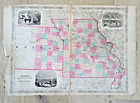
- 1889-1891 Rand McNally Map of Missouri (approx. 29" x 22")Opens in a new window or tab$34.000 bids · Time left21h 53m left (Tue, 12:56 PM)$45.00Buy It Now+$8.00 shippinggosshollow (271) 100%
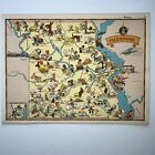
- MISSOURI Ruth Taylor VINTAGE ORIGINAL Cartoon Map 1935 6 Color Litho EX CONDOpens in a new window or tab$12.99+$6.70 shippingdotyprints (2,987) 100%
- Vintage 1866 Railroad, County & Township Map ~ KANSAS - MISSOURI ~ AuthenticOpens in a new window or tab$45.95Was: $48.886% offFree shippingmaphatter (7,634) 99.6%
- 1887 Original Antique Mitchell Maps: Minnesota & Dakota TY and Nebraska (Scarce)Opens in a new window or tab$85.00+$5.95 shippingSponsoredstudioc (1,538) 100%
- Antique Map 1920s | Map Of The Ozark Playgrounds | Steele Undertaking | 17 X 21”Opens in a new window or tab$194.40Was: $216.0010% off+$9.24 shippingSponsoredsissy_49 (847) 98.8%
- 1895 AUTHENTIC RAND MCNALLY ANTIQUE ATLAS MAP OF MISSOURI-NICE DETAIL-COLOROpens in a new window or tab$15.00+$6.00 shippingsajek (12,301) 100%
- Missouri - Map of Ellisville, Missouri - St. Louis County, Mo. - 1909Opens in a new window or tab$49.95+$5.65 shippingFree returnsacsads (2,217) 100%
- 1898 Antique MISSOURI State Map Rand McNally Atlas Map Gallery Wall Decor 1496Opens in a new window or tab$17.55Was: $19.5010% off+$4.00 shippingFree returnsTop Rated Plusplaindealing (26,121) 100%
- 1891 MISSOURI MAP ANTIQUE FULL COLOR RAILROADS MOUNTAINS VICTORIAN ERA RIVERSOpens in a new window or tab$17.75Was: $35.5050% off+$9.95 shippingFree returnsTop Rated Plusmachinebuffalo (4,514) 99.8%
- Antique 1877 Township Plat Map ~ POLLOCK STATION Twp., SULLIVAN Co., MISSOURIOpens in a new window or tab$45.95Was: $48.886% offFree shippingmaphatter (7,634) 99.6%
- USGS Topographic Map SPRINGFIELD - Missouri - 1982 - EXTREME WD! - 100K -Opens in a new window or tab$18.23Was: $21.4515% offFree shippingLast one1 watchers11% off 5+ribitz (8,684) 100%
- State of Missouri Official Road Map 1965Opens in a new window or tabPre-Owned$9.99+$3.96 shippingthejumpingfrog (126,181) 99.7%
- Antique Map of "Missouri" 1886 Ed Britanica, Free ShipOpens in a new window or tab$14.99Free 2-4 day shippingvaluablethings (6,226) 100%
- 1903 Atlas of Maps ST CLAIR County MISSOURIOpens in a new window or tab$209.99Was: $279.9925% offFree shippingFree returnsTop Rated Pluscaught-back-in-time (9,797) 99.8%
- Missouri - Map of Lake, Missouri - St. Louis County, Mo. - 1909Opens in a new window or tab$24.95+$5.65 shippingFree returnsacsads (2,217) 100%
- Missouri - Original 1896 Copper-Plate Map by AJ Johnson. AntiqueOpens in a new window or tab$17.00Free shippingFree returns20% off 5+Top Rated Plusalazarus (5,492) 100%
- 1855 Map ~ IOWA - MISSOURI - ILLINOIS ~ Authentic Atlas Map ~ (9.5x11.5) -#P309Opens in a new window or tab$27.15Was: $28.886% offFree shippingFree returnsmaphatter (7,634) 99.6%
- Rand, McNally & Co Antique 1904 Map Of Missouri 7x6Opens in a new window or tab$9.75+$4.68 shippingbenjter-51 (216) 100%
- 1907 Antique KANSAS CITY Street Map of Kansas City Missouri & Kansas 952Opens in a new window or tab$17.55Was: $19.5010% off+$4.00 shippingFree returnsTop Rated Plusplaindealing (26,121) 100%
- 1862 Johnson's Missouri and Kansas Map Johnson & Ward AntiqueOpens in a new window or tab$45.00+$9.00 shippingFree returnsTop Rated Plustheartgarage (529) 100%
- 1973 Conoco Touraide Road Map of MissouriOpens in a new window or tabPre-Owned$5.99+$5.13 shippingchobr8724 (614) 100%
- New Listing1866 Iowa & Missouri - Mitchell beautiful antique map ~ 15" x 12.2" - nice colorOpens in a new window or tab$39.00+$6.00 shippingelectronics_revolutionizers (1,865) 100%
- 1873-Campbell's Map of Missouri - 5 Counties - Camden-Dallas-Hickory -Two MoreOpens in a new window or tab$54.95+$5.65 shippingacsads (2,217) 100%
- New Listing1917 Railroad & Plat Map PARIS Twp. MONROE Co. MISSOURI ~ Crooked Creek on Rev.Opens in a new window or tab$34.000 bids · Time left4d 22h left (Sat, 01:46 PM)Free shippingmaphatter (7,634) 99.6%
- Beautiful Antique 1891 Map Of Missouri 13x11 InchesOpens in a new window or tab$19.50+$4.68 shippingbenjter-51 (216) 100%
- 1857 Colton Atlas Map ~ MISSOURI ~ (14x17) ~ Free S&H -#517Opens in a new window or tab$45.95Was: $48.886% offFree shippingFree returnsmaphatter (7,634) 99.6%
- Vintage Missouri state map page vintage 1950 Collier's Encyclopedia Rand McNallyOpens in a new window or tab$13.14Was: $14.9312% offFree shippingFree returnsTop Rated Plusamaranth_antiques_emporium (2,887) 97.7%
- 1893 MISSOURI Map, Color Counties, Historical Points, 14" x 10.5" ST. LOUISOpens in a new window or tab$17.00+$4.65 shippingrustybucketmaine (4,351) 99.8%
- 1911 INDEX MAP OF MISSOURI RIVER VICINITY OF OMAHA NEBRASKA & COUNCIL BLUFFS IA.Opens in a new window or tab$9.99+$5.25 shippingpm2828 (5,733) 100%
- Antique Rand McNally 1884 Map Of Missouri 13x10 InchesOpens in a new window or tab$24.50+$4.68 shippingbenjter-51 (216) 100%
- New Listing1887 Map ~ MISSOURI - ST LOUIS ~ Authentic Atlas Map (14x20) ~Free S&H #106Opens in a new window or tab$27.15Was: $28.886% offFree shippingmaphatter (7,634) 99.6%
- 1959 Pocket Map of Downtown ST LOUIS Missouri WAYCO PARKING GARAGES STATIONSOpens in a new window or tabPre-Owned$10.99+$5.15 shippingrbrezstuff (1,044) 100%
- 1883 Antique Map / STATE OF MISSOURI / 14.5x20.5 inchesOpens in a new window or tab$19.99Free shippingpaulishere (20,603) 99.3%
- New Listing1917 Railroad & Plat Map MADISON Twp., MONROE Co. MISSOURI ~ STOUTSVILLE on rev.Opens in a new window or tab$34.000 bids · Time left4d 21h left (Sat, 12:14 PM)Free shippingmaphatter (7,634) 99.6%
- New Listing1917 Railroad & Plat Map MADISON Twp. MONROE Co. MISSOURI - LEESBURG on ReverseOpens in a new window or tab$34.000 bids · Time left4d 21h left (Sat, 12:25 PM)Free shippingmaphatter (7,634) 99.6%
- Hammond’s Antique 1914 Map Of Missouri 6x8Opens in a new window or tab$9.25+$4.68 shippingbenjter-51 (216) 100%
- 1864 Map Missouri and Iowa County Map Antique Original Hand Colored MitchellOpens in a new window or tab$49.50+$5.85 shippingFree returnsTop Rated Plussalsaman1 (9,274) 100%
- New ListingSovereign Service Highway Map of MissouriOpens in a new window or tabPre-Owned$7.99Was: $9.9920% off+$4.43 shippingblastfromthepastemporium (6,283) 100%
- Antique 1914 Map Of Kansas City (Missouri & Kansas) 11x15 InchesOpens in a new window or tab$19.50+$4.68 shippingSponsoredbenjter-51 (216) 100%
- 1851 UNITED STATES OF AMERICA ORIGINAL TALLIS MAP 11x14 WM84Opens in a new window or tab$299.95+$7.45 shippingSponsoredpapertique (3,551) 99.4%
- Items Per Page