25,000+ results for pa map
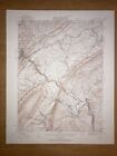
- Burgettstown PA Washington USGS Topographical Geological Survey Quadrangle MapOpens in a new window or tab$9.95+$7.83 shippingFree returnsSponsoredTop Rated Plusoldsol (14,870) 100%
- Philadelphia, PA - Original 1910 Dated City Map by Dodd Mead & CompanyOpens in a new window or tab$38.00Free shippingFree returnsSponsored20% off 5+Top Rated Plusalazarus (5,492) 100%
- New Listing1869 Map: Rome Borough & Twp, Bradford Co., Pa. W/ Residents' Names, Landmarks +Opens in a new window or tab$7.50+$5.90 shippingFree returnsSponsoredmr.books (5,779) 99.8%
- New Listing1869 Atlas Map: Litchfield Township, Bradford County., Pa. With Names, Etc.Opens in a new window or tab$7.50+$5.90 shippingFree returnsSponsoredmr.books (5,779) 99.8%
- 1872 antique hand colored MAP pa CUMBERLAND FRANKLIN ADAMS co 17.25"x13.75"Opens in a new window or tab$67.50+$11.80 shippingFree returnsSponsoredTop Rated Plusantique.cottage (12,556) 100%
- ORIGINAL 1865 Clarion County PA Map WITH ORIGINAL WOOD RODSOpens in a new window or tab$290.00+$18.00 shippingSponsoredsalvationisfree (482) 100%
- Cameron-Elk PA Counties 1958 Waters-Highway Map 1966 Deer&Bear Harvest ReportOpens in a new window or tab$15.00+$4.50 shippingSponsoredpaknockerstiffer (859) 100%
- BUCKS COUNTY PA 1966 Map Rare Never UsedOpens in a new window or tab$49.99Free shippingSponsorednuttyfrephemera (81) 98.8%
- CL13 Original Antique Map c. 1877 Limestone, Highland,Smithland, Clarion Cty, PAOpens in a new window or tab$95.00+$14.99 shippingSponsoredcaromi (263) 100%
- Montgomery County, PA street and road map - EB051Opens in a new window or tab$9.95Free shippingSponsoredmarleichte0 (85) 100%
- Tioga PA County USGS Topographical Geological Survey Quadrangle Old MapOpens in a new window or tab$9.95+$7.83 shippingFree returnsSponsoredTop Rated Plusoldsol (14,870) 100%
- CL22 Original Pict Antique Map c. 1877 (5) Business & Residence, Clarion Cty, PAOpens in a new window or tab$55.00+$14.99 shippingSponsoredcaromi (263) 100%
- 1872 Plat Map ~ CLINTON - FOREST CITY Twps., WAYNE Co., PA ~ (13x16) -#013Opens in a new window or tab$34.000 bids · Time left22h 13m left (Mon, 01:24 PM)Free shippingFree returnsSponsoredmaphatter (7,634) 99.6%
- Lebanon PA Lebanon County USGS Topographical Geological Survey Quadrangle MapOpens in a new window or tab$9.95+$7.83 shippingFree returnsSponsoredTop Rated Plusoldsol (14,870) 100%
- Uniontown PA Fayette County USGS Topographical Geological Survey Quadrangle MapOpens in a new window or tab$9.95+$7.83 shippingFree returnsSponsoredTop Rated Plusoldsol (14,870) 100%
- Rare 1986 Bob Terrio Philadelphia 1787, Pennsylvania Pictorial Map, City PlanOpens in a new window or tab$202.30Was: $289.0030% off+$14.80 shippingBenefits charitySponsoredretrojawns (858) 99.7%
- ORIGINAL 1875 Lancaster PA Map - Manor TownshipOpens in a new window or tab$24.99Free 2-3 day shippingSponsoredbretts (46,038) 99.8%
- 1860 Map ~ PHILADELPHIA - Original Authentic Mitchell Atlas Map (12.5x15.5)Opens in a new window or tab$57.99+$5.90 shippingSponsoredstoutzgeneralstore (279) 98.8%
- NEW JERSEY PENNSYLVANIA NJ PA State Map AAA Road Tour Map NEWOpens in a new window or tabBrand New$12.00Free shippingAlmost gone18 soldSponsoredSave up to 10% when you buy morethelocalliquidation (1,016) 99.6%
- Kane PA McKean County Old USGS Topographical Geological Survey Quadrangle MapOpens in a new window or tab$9.95+$7.83 shippingFree returnsSponsoredTop Rated Plusoldsol (14,870) 100%
- CENTURY ATLAS MAP PLATE #16 PENNSYLVANIA WESTERN PITTSBURG PA 1911 ANTIQUE ORIGOpens in a new window or tab$19.95Free shippingSponsoredquinn.thrift (129) 100%
- New Cumberland PA County Old USGS Topographical Geological Survey Quadrangle MapOpens in a new window or tab$9.95+$7.83 shippingFree returnsSponsoredTop Rated Plusoldsol (14,870) 100%
- 1878 antique foldout LANCASTER MUDDY RUN to FISHING CREEK pa GEOLOGICAL MAPOpens in a new window or tab$28.95+$6.95 shippingFree returnsSponsoredTop Rated Plusantique.cottage (12,556) 100%
- 1885 McNally Map - Pennsylvania - Philadelphia Pittsburgh Erie Harrisburg - PAOpens in a new window or tab$16.00Was: $20.0020% off+$4.99 shippingFree returnsSponsoredTop Rated Plusc574778 (15,782) 99.6%
- New Listing1882 Plat Map ~ SPRINGFIELD - RIDLEY - DARBY, PA (XXL18x28) Free S&H -#013Opens in a new window or tab$64.75Was: $68.886% offFree shippingFree returnsSponsoredmaphatter (7,634) 99.6%
- 1872 Plat Map ~ DYBERRY - BETHANY Twps., WAYNE Co., PA ~ (13x16) -#014Opens in a new window or tab$34.000 bids · Time left22h 31m left (Mon, 01:42 PM)Free shippingFree returnsSponsoredmaphatter (7,634) 99.6%
- 1876 Plat Map ~ PENN Twp. BERKS Co. PA Ancestry Genealogy Land Title HistoryOpens in a new window or tab$45.95Was: $48.886% offFree shippingSponsoredmaphatter (7,634) 99.6%
- New Listing1882 Plat Map ~ BURD ORPHAN ASYLUM - UPPER DARBY, PA - (XXL18x28) Free S&H -#005Opens in a new window or tab$64.75Was: $68.886% offFree shippingFree returnsSponsoredmaphatter (7,634) 99.6%
- 39 Pennsylvania Geological Survey Maps circa 1960's/1970's/1980'sOpens in a new window or tab$85.50Was: $95.0010% off+$25.00 shippingSponsoredhallsnostalgia (19,317) 100%
- Antique 1924 Rand McNally Auto Trails Map district 7 md ny nj pa va wv 100 yrsOpens in a new window or tab$85.00Free shippingSponsoreddevicetech (1,110) 100%
- Original Lake Wallenpaupack Area Map Hand Drawn Property Map From 1950Opens in a new window or tab$695.00+$25.00 shippingSponsoredmariarmama (116) 100%
- ANTIQUE Colored Map of MONTROSE - PENNSYLVANIA / A. Pomeroy & Co. 1872Opens in a new window or tab$165.00+$7.00 shippingSponsoredbook14850 (3,437) 99.3%
- New Listing1882 Plat Map ~ SHARON HILL - DARBY, PA (XXL18x28) Free S&H -#008Opens in a new window or tab$64.75Was: $68.886% offFree shippingFree returnsSponsoredmaphatter (7,634) 99.6%
- 1872 Plat Map ~ LEBANON - COLD SPRING Twps., WAYNE Co., PA ~ (13x16) -#010Opens in a new window or tab$34.000 bids · Time left22h 57m left (Mon, 02:08 PM)Free shippingFree returnsSponsoredmaphatter (7,634) 99.6%
- New Listing1882 Plat Map ~ CRUMB CREEK - SPRINGFIELD, PA (14x18) Free S&H -#015Opens in a new window or tab$45.95Was: $48.886% offFree shippingFree returnsSponsoredmaphatter (7,634) 99.6%
- New Listing1882 Plat Map ~ SHARON HILL - COBBS CREEK - DARBY, PA (XXL18x28) Free S&H -#009Opens in a new window or tab$64.75Was: $68.886% offFree shippingFree returnsSponsoredmaphatter (7,634) 99.6%
- Antique Map 1914 City Of Pittsburgh PA 11x15 InchesOpens in a new window or tab$19.50+$4.68 shippingSponsoredbenjter-51 (215) 100%
- Philadelphia PA Old USGS Topographical Geological Survey Quadrangle Topo MapOpens in a new window or tab$9.95+$7.83 shippingFree returnsSponsoredTop Rated Plusoldsol (14,870) 100%
- 1842 Large Map of Pennsylvania. From Morse's North American AtlasOpens in a new window or tab$135.00+$12.00 shippingSponsoredbook14850 (3,437) 99.3%
- Vintage Slate Run PA HAND DRAWN Quadrangle Road MapOpens in a new window or tab$30.11Free shippingFree returnsSponsoredTop Rated Plusbeezersbooks (12,181) 99.8%
- Antique Map Buisiness Notice Shickshinny From 1873 Atlas Pg 173 Pennsylvania PAOpens in a new window or tab$23.75Was: $25.005% off+$8.45 shippingSponsoredacn_vintage (738) 100%
- 1878 Geological Map - Butler County Pennsylvania - by Lesley - PA Geology SurveyOpens in a new window or tab$11.99Was: $14.9920% off+$4.99 shippingFree returnsSponsoredTop Rated Plusc574778 (15,782) 99.6%
- Vintage Maps NYC DC PA Co Maine VA CA 20 Total LotOpens in a new window or tab$15.00+$5.20 shippingSponsoredthepinkflamingo111 (377) 100%
- Mt. Jewett PA McKean County USGS Topographical Geological Survey Quadrangle MapOpens in a new window or tab$9.95+$7.83 shippingFree returnsSponsoredTop Rated Plusoldsol (14,870) 100%
- 1876 Plat Map SAEGERTOWN, CRAWFORD Co., PA / LINESVILLE on Reverse -#022Opens in a new window or tab$45.95Was: $48.886% offFree shippingSponsoredmaphatter (7,634) 99.6%
- ORIGINAL 1875 Lancaster PA Map - Columbia Borough, Little Britain, Sadsbury TwpsOpens in a new window or tab$24.99Free 2-3 day shippingSponsoredbretts (46,038) 99.8%
- 1873 antique RANSOM MILWAUKIE luzerne county MAP from Atlas w. h. gamble PaOpens in a new window or tab$47.50+$11.80 shippingFree returnsSponsoredTop Rated Plusantique.cottage (12,556) 100%
- 1857 Morse Map Pennsylvania - Erie Philadelphia Pittsburgh Allentown HarrisburgOpens in a new window or tab$19.99Was: $24.9920% off+$4.99 shippingFree returnsSponsoredTop Rated Plusc574778 (15,782) 99.6%
- Benezette PA Elk County USGS Topographical Geological Survey Quadrangle Old MapOpens in a new window or tab$9.95+$7.83 shippingFree returnsSponsoredTop Rated Plusoldsol (14,870) 100%
- 1876 Plat Map CONNEAUTVILLE, CRAWFORD Co., PA / E. HUIDEKOPER on Reverse -#024Opens in a new window or tab$45.95Was: $48.886% offFree shippingSponsoredmaphatter (7,634) 99.6%
- Beaver PA County Old USGS Topographical Geological Survey Quadrangle MapOpens in a new window or tab$9.95+$7.83 shippingFree returnsSponsoredTop Rated Plusoldsol (14,870) 100%
- c 1949 Antique Map Pennsylvania Philadelphia Pittsburgh Harrisburg Erie ReadingOpens in a new window or tab$12.00Was: $15.0020% off+$4.99 shippingFree returnsSponsoredTop Rated Plusc574778 (15,782) 99.6%
- 1876 Plat Map ~ LONG SWAMP Twp. BERKS Co. PA Ancestry Genealogy Land HistoryOpens in a new window or tab$45.95Was: $48.886% offFree shippingSponsoredmaphatter (7,634) 99.6%
- 1884 Pennsylvania Geology Map Montgomery Pottstown Norristown Philadelphia PAOpens in a new window or tab$15.99Was: $19.9920% off+$4.99 shippingFree returnsSponsoredTop Rated Plusc574778 (15,782) 99.6%
- C. 1880 Map Of East Nantmeal, PA, Hand-Colored 20 x 28” Double-PageOpens in a new window or tab$24.95+$18.80 shippingSponsoredrobinrarebooks (2,317) 100%
- ORIGINAL 1875 Lancaster PA Map - Elizabethtown, Spring GardenOpens in a new window or tab$24.99Free 2-3 day shippingSponsoredbretts (46,038) 99.8%
- 1876 Plat Map ~ HAMBURG Bor. BURKS Co. PA Ancestry Genealogy Land HistoryOpens in a new window or tab$45.95Was: $48.886% offFree shippingSponsoredmaphatter (7,634) 99.6%
- Carlisle PA Cumberland Co. USGS Topographical Geological Survey Quadrangle MapOpens in a new window or tab$9.95+$7.83 shippingFree returnsSponsoredTop Rated Plusoldsol (14,870) 100%
- Alum Bank Pa. Bedford USGS Topographical Geological Survey Quadrangle Old MapOpens in a new window or tab$9.95+$7.83 shippingFree returnsSponsoredTop Rated Plusoldsol (14,870) 100%
- Original WILKES- BARRE Pa 1894 - Reprinted 1936 USGS Topo Map 16 1/2” X 20”Opens in a new window or tab$29.99+$4.99 shippingSponsoredjetaceal (11,757) 100%
- ORIGINAL 1875 Lancaster PA Map - Earl Township, Upper Leacock Township, EphrataOpens in a new window or tab$24.99Free 2-3 day shippingSponsoredbretts (46,038) 99.8%
- Vintage 1900 PHILADELPHIA PENNSYLVANIA Map 22"x14" Old Antique Original PAOpens in a new window or tab$35.99Was: $49.9928% offFree shippingSponsoreduncommon_maps (2,931) 100%
- 1872 Hand-Colored Atlas Map Of Bendersville, Adams Co., PA 13-5/8” x 15-3/8”Opens in a new window or tab$24.95+$14.80 shippingSponsoredrobinrarebooks (2,317) 100%
- New ListingPA Map North Central Pennsylvania Mountains Travel Guide Discovery MapOpens in a new window or tabPre-Owned$19.99+$6.65 shippingFree returnsSponsored15% off 2+ with couponTop Rated Pluskingdom_thrift_yards (1,588) 100%
- 1876 Plat Map DISTRICT Twp. BERKS Co. PA Ancestry Genealogy Land Title HistoryOpens in a new window or tab$45.95Was: $48.886% offFree shippingSponsoredmaphatter (7,634) 99.6%
- 1949 City Map of Philadelphia PA 14x11" sheet streets parks points of interestOpens in a new window or tab$4.99+$6.50 shippingSponsoredkistlerinternetauctions (31,996) 99.8%
- 1896 Map ~ VACINITY of PHILADELPHIA, PENNSYLVANIA ~ (11x13)Free S&H-#037Opens in a new window or tab$27.15Was: $28.886% offFree shippingSponsoredmaphatter (7,634) 99.6%
- Tyrone PA Blair County USGS Topographical Geological Survey Quadrangle Old MapOpens in a new window or tab$9.95+$7.83 shippingFree returnsSponsoredTop Rated Plusoldsol (14,870) 100%
- 1864 ANTIQUE BRIDGENS' PLAT ATLAS OF LANCASTER COUNTY, PA-MAP OF FULTON TWP.Opens in a new window or tab$10.00+$7.00 shippingSponsoredsajek (12,301) 100%
- ORIGINAL 1875 Lancaster PA Map - Warwick Township - Elizabeth Farms Etc. Illus.Opens in a new window or tab$24.99Free 2-3 day shippingSponsoredbretts (46,038) 99.8%
- 7 Vintage 1930s 40s PA Dept Internal Affairs Topographical Maps Altoona Tyrone +Opens in a new window or tab$53.10Was: $59.0010% off+$8.45 shippingSponsoredmarcy13 (23,044) 100%
- Vintage Map: Portraiture of City of Philadelphia in The Province PennsylvaniaOpens in a new window or tab$199.00Free shippingSponsoredlemonsandapples (5,653) 99.9%
- 1908 Geological Survey Book Maps Magnetite Deposits Cornwall Type PennsylvaniaOpens in a new window or tab$35.00+$5.00 shippingSponsoredseester2 (4,507) 100%
- Items Per Page