


14,000+ results for massachusetts map
- Massachusetts State Executive City-County Laminated Wall MapOpens in a new window or tabBrand New$39.95 to $99.95Buy It NowFree shippingFree returnsswiftmaps (22,533) 98.8%
- Vintage 1891 BOSTON MASSACHUSETTS Map 11"x14" ~ Old Antique Original CHARLESTOWNOpens in a new window or tab$43.16Was: $59.9528% offor Best OfferFree shippinguncommon_maps (2,944) 100%
- OLD 1812 UNITED STATES Map ORIGINAL 1776 Northwestern Territory Wisconsin 1897Opens in a new window or tab$58.00or Best OfferFree shippingFree returnsselsa84 (5,132) 100%
- Boston Harbor Massachusetts Coastal Survey 1850 Blunt nautical map hand colorOpens in a new window or tab$157.50Was: $175.0010% offBuy It Now+$6.95 shippingoldmapsoldbooks (12,114) 100%
- MASSACHUSETTS STATE MAP AND LANDMARKS COLLAGE FRIDGE COLLECTIBLE SOUVENIR MAGNETOpens in a new window or tabBrand New$7.61Was: $8.4510% offBuy It NowFree 2-4 day shippingSave up to 10% when you buy moreworldbyshotglass (14,396) 100%
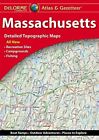
- Massachusetts State Atlas & Gazetteer, by DeLormeOpens in a new window or tabBrand New$9.95Buy It Now+$6.61 shippingFree returnsmapguys22 (8,682) 99.7%
- 1890 Topographical Map, PROVINCETOWN SHEET, MA - TRURO, RACE POINT (15x20)-#50Opens in a new window or tab$34.000 bids · Time left1d 7h left (Thu, 02:58 PM)Free shippingmaphatter (7,670) 99.6%
- 1890 Topographical Map, NANTUCKET SHEET, MA - SQUAM HEAD, GREAT NECK (15x20)-#53Opens in a new window or tab$34.001 bid · Time left1d 7h left (Thu, 03:02 PM)Free shippingmaphatter (7,670) 99.6%
- 1858 Berkshire County Mass MA Antique Map Henry Walling Smith Gallup 63”x62”Opens in a new window or tab$150.001 bid · Time left4d 9h left (Sun, 05:12 PM)+$22.70 shippingscratchtest (4,738) 100%
- New Listingroad maps lot. Connecticut Massachusetts Rhode Island, Pennsylvania, ArkansasOpens in a new window or tabPre-Owned$3.00or Best Offer+$5.80 shippingdeanna321 (224) 100%
- Massachusetts Postcard: Map Of Massachusetts- The Bay StateOpens in a new window or tabPre-Owned$2.00or Best Offer+$1.50 shippingteddym29 (1,636) 100%
- Map of Essex Rockport Gloucester Mass Vintage MA Massachusetts MapOpens in a new window or tab$43.69Was: $45.995% offor Best OfferFree shippingtheestatekings (16,052) 99.4%
- vintage automobile routes of Massachusetts map Walker lithographOpens in a new window or tab$34.84Buy It Now+$8.18 shippingtranceferret (614) 100%
- Vintage 1892 BOSTON MASSACHUSETTS Map 11"x14" Old Antique Original BEANTOWN MAOpens in a new window or tab$39.56Was: $54.9528% offor Best OfferFree shippinguncommon_maps (2,944) 100%
- Vintage 1891 BOSTON MASSACHUSETTS Map 11"x14" Old Antique Original CHARLESTOWNOpens in a new window or tab$42.44Was: $58.9528% offor Best OfferFree shippinguncommon_maps (2,944) 100%
- Boston Massachusetts Road Map Park System 1894 Walker large city plan mapOpens in a new window or tab$76.50Was: $85.0010% offBuy It Now+$6.95 shippingoldmapsoldbooks (12,114) 100%
- 1890 Topographical Map, WELLFLEET SHEET, MA - TRURO, BREWSTER EASTHAM (15x20)#51Opens in a new window or tab$34.000 bids · Time left1d 7h left (Thu, 03:08 PM)Free shippingmaphatter (7,670) 99.6%
- New ListingMassachusetts Historic Vacationland Travel Map 1964. -- 3937Opens in a new window or tab$9.99or Best Offer+$4.38 shippingswisspicking (49) 100%
- New ListingMap Of Massachusetts, Connecticut And Rhode Island, Brown & Parsons, 1845,Opens in a new window or tab$350.00Buy It Now+$5.90 shippingrickscoolstuff1 (2,929) 100%
- Antique Map 1890 Massachusetts Rhode Island Connecticut or Vermont New HampshireOpens in a new window or tab$9.95or Best Offer+$5.15 shippingFree returnsTop Rated Plussalsaman1 (9,294) 100%
- 1890 Topographical Map, MUSKEGET SHEET, MA - TUCKERNUCK, NANTUCKET (15x20)-#49Opens in a new window or tab$34.000 bids · Time left1d 7h left (Thu, 02:56 PM)Free shippingmaphatter (7,670) 99.6%
- New ListingVtg Embroidered Deocrative Novelty Map Cape Cod MA 15X13 Circa 1930s AS ISOpens in a new window or tab$49.000 bids · Time left6d 13h left (Tue, 09:21 PM)+$8.60 shippingcatamountcurios (2,905) 100%
- New ListingMAPTECH Massachusetts Bay Boston Harbor Nautical Map Waterproof Folding 36"x24"Opens in a new window or tab$12.88Buy It NowFree shippingevescollection (12,074) 100%
- Antique 1903 Map Amherst Massachusetts Area Northampton Leeds 21"X36" #21001Opens in a new window or tab$39.99Buy It NowFree 2-4 day shippingnc27012 (25,100) 100%
- 1871 WALLING & GRAY ATLAS MAP OF NEW BEDFORD, MASSACHUSETTS-HAND COLOREDOpens in a new window or tab$15.00Buy It Now+$7.00 shippingsajek (12,313) 100%
- 1920s “Cape Ann and the North Shore” Vintage Style Massachusetts Map - 20x24Opens in a new window or tabBrand New$16.95Buy It Now+$5.95 shippingFree returns6 watchersBuy 2, get 1 freeTop Rated Plusartscape_galleries (33,184) 99.5%
- 1870 Map Clinton Massachusetts Hand Colored Beers Worcester CountyOpens in a new window or tab$9.95Buy It Now+$4.95 shippingtholc13krab (37,082) 99.9%
- 1870 Map Webster Massachusetts Hand Colored Beers Worcester CountyOpens in a new window or tab$9.95Buy It Now+$4.95 shippingtholc13krab (37,082) 99.9%
- Greenfield Franklin County Massachusetts 1871 F.W. Beers detailed city plan mapOpens in a new window or tab$157.50Was: $175.0010% offBuy It Now+$6.95 shippingoldmapsoldbooks (12,114) 100%
- Vintage 1902 BOSTON MASSACHUSETTS Map 14"x22" Old Antique Original TEA PARTYOpens in a new window or tab$28.04Was: $38.9528% offor Best OfferFree shippinguncommon_maps (2,944) 100%
- Walpole Township Norfolk County Massachusetts 1871 very detailed map w/ ownersOpens in a new window or tab$67.50Was: $75.0010% offBuy It Now+$6.95 shippingoldmapsoldbooks (12,114) 100%
- Stoneham Middlesex County Massachusetts 1875 F.W. Beers detailed mapOpens in a new window or tab$54.00Was: $60.0010% offBuy It Now+$6.95 shippingoldmapsoldbooks (12,114) 100%
- 1874 Map ~ NEW ENGLAND & LOWER CANADA by H.H. LLOYD ~ (15x17)-#002Opens in a new window or tab$48.002 bids · Time left1d 5h left (Thu, 12:43 PM)Free shippingmaphatter (7,670) 99.6%
- 1839 Antique Map of Massachusetts Published by Dorr Howland & Co.Opens in a new window or tab$50.00or Best OfferFree shippingpcbcompany (7,690) 99.7%
- 1890 Topographical Map, SAKONNET SHEET, MASSACHUSETTS (15x20)-#35Opens in a new window or tab$34.000 bids · Time left1d 7h left (Thu, 02:34 PM)Free shippingmaphatter (7,670) 99.6%
- Hudson Massachusetts 1875 F.W. Beers - Handcolored Vintage MapOpens in a new window or tab$20.00or Best OfferFree 2-4 day shippingrutcollect (22,361) 99.9%
- Greetings from Massachusetts (Map) FRIDGE MAGNET travel souvenirOpens in a new window or tabBrand New$7.49 to $9.49Buy It NowFree shippingFree returnsBuy 3, get 3 freebluecrabmagnets (47,534) 99.7%
- Medford Massachusetts 1991 FOLD OUT MAP ISSUED BY WOLFSON REAL ESTATE - VINTAGEOpens in a new window or tab$11.99or Best Offer+$4.03 shippingsummerson2004 (1,537) 100%
- Warwick Franklin County Massachusetts 1871 Beers genealogy detailed mapOpens in a new window or tab$58.50Was: $65.0010% offBuy It Now+$6.95 shippingoldmapsoldbooks (12,114) 100%
- Cape Ann Harbor Massachusetts Gloucester 1837 Blunt Hooker coastal survey mapOpens in a new window or tab$85.50Was: $95.0010% offBuy It Now+$6.95 shippingoldmapsoldbooks (12,114) 100%
- 1949 City Map of Boston Massachusetts 14x11" sheet streets parks points interestOpens in a new window or tab$4.99Buy It Now+$6.50 shippingkistlerinternetauctions (32,055) 99.8%
- MapEasy's Guide map to Boston, MassachusettsOpens in a new window or tabBrand New$3.95Buy It Now+$4.30 shippingFree returns41 soldmapguys22 (8,682) 99.7%
- Massachusetts, Connecticut & Rhode Island - Original 1882 Map by Phillips & HuntOpens in a new window or tab$18.00Buy It NowFree 2-4 day shippingFree returns20% off 5+Top Rated Plusalazarus (5,496) 100%
- 1874 G.M. HOPKINS ATLAS OF CITY OF SALEM, MASSACHUSETTS-MAP OF SALEM, PLATE GOpens in a new window or tab$9.95Buy It Now+$7.00 shippingsajek (12,313) 100%
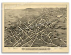
- Antique Circa 1914 Bird's Eye View Boston Harbor Illustrated Novelty Map 20X16Opens in a new window or tab$75.000 bids · Time left4d 14h left (Sun, 10:07 PM)+$8.60 shippingcatamountcurios (2,905) 100%
- Massachusetts North America Map 1935 United States 14 x 11" New England LGAD99Opens in a new window or tab$20.00Was: $49.9960% offor Best Offer+$8.60 shippingFree returnsTop Rated Plussavagesalesofmaine (1,794) 99.9%
- MapEasy's Guide map to Boston, MassachusettsOpens in a new window or tabPre-Owned$3.95Buy It Now+$5.25 shippingpurplehat0_1 (1,445) 100%
- 1890 Topographical Map, MARLBORO SHEET - SHREWSBURY, HARVARD, MA (15x20)-#023Opens in a new window or tab$34.000 bids · Time left1d 6h left (Thu, 02:08 PM)Free shippingmaphatter (7,670) 99.6%
- Rare Circa 1946 Nantucket MA Illustrated Novelty Map 32X23 Ruth Haviland SuttonOpens in a new window or tab$149.000 bids · Time left4d 14h left (Sun, 09:25 PM)+$20.00 shippingcatamountcurios (2,905) 100%
- Bird's Eye View 1885 Hingham Massachusetts Vintage Style City Map - 16x24Opens in a new window or tabBrand New$13.95Buy It Now+$5.95 shippingFree returnsBuy 2, get 1 freeTop Rated Plusartscape_galleries (33,184) 99.5%
- 1890 Topographical Map, GRANVILLE SHEET - WESTFIELD, BLANDFORD, MA (15x20)-#009Opens in a new window or tab$34.000 bids · Time left11h 44m left (Today 07:09 PM)Free shippingmaphatter (7,670) 99.6%
- Map of Boston, Massachusetts, Laminated Street Map by StreetwiseOpens in a new window or tabBrand New$5.95Buy It Now+$4.30 shippingFree returnsmapguys22 (8,682) 99.7%
- New ListingMassachusetts Map Outline Dad Baseball Cap Patch Cotton Adjustable Dad HatOpens in a new window or tabPre-Owned$10.00Buy It NowFree shippingtheluckysaver (1,319) 99.7%
- Natick South Natick Felchville Massachusetts 1875 F.W. Beers - Handcolored MapOpens in a new window or tab$20.00or Best OfferFree 2-4 day shippingrutcollect (22,361) 99.9%
- 1959 - 1960 Massachusetts official highway state road map 16 page bookletOpens in a new window or tabPre-Owned$12.99Buy It Now+$2.99 shippingcbloom (17,441) 99.6%
- Nantasket Beach Massachusetts 1879 Historic Panoramic Town Map - 20x30Opens in a new window or tabBrand New$18.95Buy It Now+$5.95 shippingFree returnsBuy 2, get 1 freeTop Rated Plusartscape_galleries (33,184) 99.5%
- 1870 Map Webster Massachusetts Hand Colored Beers Worcester CountyOpens in a new window or tab$9.95Buy It Now+$4.95 shippingtholc13krab (37,082) 99.9%
- Vintage 1891 Atlas Map ~ CITY of GLOUCESTER, MASSACHUSETTS Antique & AuthenticOpens in a new window or tab$45.95Was: $48.886% offor Best OfferFree shippingmaphatter (7,670) 99.6%
- 1973-4 Massachusetts Official Road Map – Dept. of Public Works (1-73)Opens in a new window or tab$9.99Buy It Now+$5.90 shippingFree returnsTop Rated Pluscraigsolo (6,360) 100%
- ORIGINAL 1849 Antique Engraved Map - BOSTON, MASSACHUSETTS - G.W. BoyntonOpens in a new window or tab$76.00Was: $95.0020% offor Best Offer+$8.80 shippingFree returnsTop Rated Plusthegrandcurio (512) 100%
- 1890 Topographical Map, BLACKSTONE SHEET - GRAFTON, UXBRIDGE, MA (15x20)-#024Opens in a new window or tab$34.000 bids · Time left1d 6h left (Thu, 02:12 PM)Free shippingmaphatter (7,670) 99.6%
- 1887 Map ~ PLAN of BOSTON, MASSACHUSETTS (15x24)-#030Opens in a new window or tab$83.55Was: $88.886% offor Best OfferFree shippingFree returnsmaphatter (7,670) 99.6%
- Rand, McNally & Co Antique 1904 Map Of Massachusetts 7x6Opens in a new window or tab$9.75Buy It Now+$4.68 shippingbenjter-51 (229) 100%
- 1920s “Map of the Island of Nantucket” Vintage Style Tony Sarg Map - 16x20Opens in a new window or tabBrand New$13.95Buy It Now+$5.95 shippingFree returns50 soldBuy 2, get 1 freeTop Rated Plusartscape_galleries (33,184) 99.5%
- Massachusetts State Map Lapel PinOpens in a new window or tabBrand New$8.95or Best OfferFree shippingSave up to 15% when you buy morepredators77 (2,345) 99.5%
- 1890 Topographical Map, ABINGTON SHEET, MA - SCITUATE, PEMBROKE (15x20)#39Opens in a new window or tab$34.000 bids · Time left1d 7h left (Thu, 02:40 PM)Free shippingmaphatter (7,670) 99.6%
- 1890 Topographical Map, BOSTON BAY SHEET, MA - HULL, SWAMPSCOTT, LYNN (15x20)#38Opens in a new window or tab$34.000 bids · Time left1d 7h left (Thu, 02:38 PM)Free shippingmaphatter (7,670) 99.6%
- Boston Massachusetts city plan 1908 huge detailed Rand McNally mapOpens in a new window or tab$38.50Was: $55.0030% offBuy It Now+$4.95 shippingFree returnsantiquemapsprints (16,558) 96.9%
- 1930s Cape Cod Massachusetts Historic Early Map - 16x24Opens in a new window or tabBrand New$13.95Buy It Now+$5.95 shippingFree returns64 soldBuy 2, get 1 freeTop Rated Plusartscape_galleries (33,184) 99.5%
- 1891 Massachusetts Railroad & Township Map ~ FLORIDA - SHELBURNE - CHARLEMONTOpens in a new window or tab$45.95Was: $48.886% offor Best OfferFree shippingmaphatter (7,670) 99.6%
- 1877 Map MASSACHUSETTS, CONNECTICUT, RHODE ISLAND ~ Authentic Mitchell Map -#039Opens in a new window or tab$18.80Was: $20.006% offor Best OfferFree shippingmaphatter (7,670) 99.6%
- Cape Ann Massachusetts 1927 Vintage Style Illustrated Map - 16x20Opens in a new window or tabBrand New$13.95Buy It Now+$5.95 shippingFree returns25 soldBuy 2, get 1 freeTop Rated Plusartscape_galleries (33,184) 99.5%
- 1890 Topographical Map, MARTHAS VINEYARD SHEET, MA - CHAPPAQUIDDICK (15x20)-#47Opens in a new window or tab$34.001 bid · Time left1d 7h left (Thu, 02:56 PM)Free shippingmaphatter (7,670) 99.6%
- Bird's Eye View 1878 Holliston Massachusetts Vintage Style City Map - 18x24Opens in a new window or tabBrand New$13.95Buy It Now+$5.95 shippingFree returnsBuy 2, get 1 freeTop Rated Plusartscape_galleries (33,184) 99.5%
- Foxborough Norfolk County Massachusetts 1871 detailed mapOpens in a new window or tab$67.50Was: $75.0010% offBuy It Now+$6.95 shippingoldmapsoldbooks (12,114) 100%
- Newburyport Harbor Massachusetts Coastal Survey c. 1910 fine nautical chart mapOpens in a new window or tab$225.00Was: $250.0010% offBuy It Now+$11.60 shippingoldmapsoldbooks (12,114) 100%
- Items Per Page